ORLANDO, Fla. – The parade of cold fronts has begun. The first, crossing Central Florida Friday evening, is slightly dropping temperatures while also producing scattered showers.
Expect scattered showers to continue through the evening.
Late Friday evening and especially overnight, expect skies to quickly clear as cooler, drier air rushes in,
It will turn mostly sunny and much cooler for the weekend with highs in the upper 60s and lower 70s. Morning temperatures Saturday and Sunday will dip into the 40s and low 50s.
A secondary front, crossing later in the day Sunday will bring a blast of Arctic air back to Central Florida.
Highs will be held in the 60s Monday through Wednesday. A few areas northwest of I-4 will struggle to climb out of the 50s Tuesday.
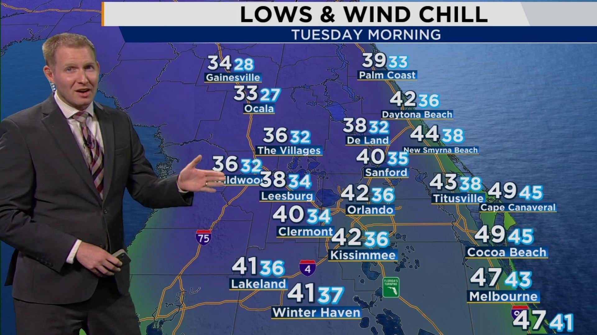
The coldest mornings of the bunch will be Tuesday and Wednesday with temperatures dipping into the 30s and 40s.
With the wind factored in it will feel like the mid 30s across most of Central Florida.
Wind chill isn’t just a number to make it look colder than it actually is. When wind is present, the heat produced by your body is pushed away, exposing you to the cold.
The stronger the wind, the lower the wind chill factor.
Wind chill is an apparent temperature and only applies to living things. Inanimate objects like pipes are not impacted by the wind.
Copyright 2024 by WKMG ClickOrlando – All rights reserved.

