
Drizzle and some light rain will develop early Wednesday morning. A period of freezing drizzle north of the metro with limited impacts, mainly on elevated surfaces.
ST. LOUIS — The 5 On Your Side Weather Impact Team is expecting drizzle and light rain to develop early Wednesday, most likely around sunrise. With temperatures near or just below freezing, freezing rain seems likely north of St. Louis. The area of freezing rain and drizzle is expected from Bowling Green, MO toward Litchfield, IL, with rain for most of the rest of the St. Louis area.
As of Wednesday morning, the National Weather Service expanded the Winter Weather Advisory to now include Lincoln, Montgomery co., MO and Greene and Calhoun co., IL until 6 p.m. Pike county, MO was originally in this advisory and remains to be the area with the highest impact with upwards of a tenth of an inch of ice accumulation with only a glaze expected elsewhere.
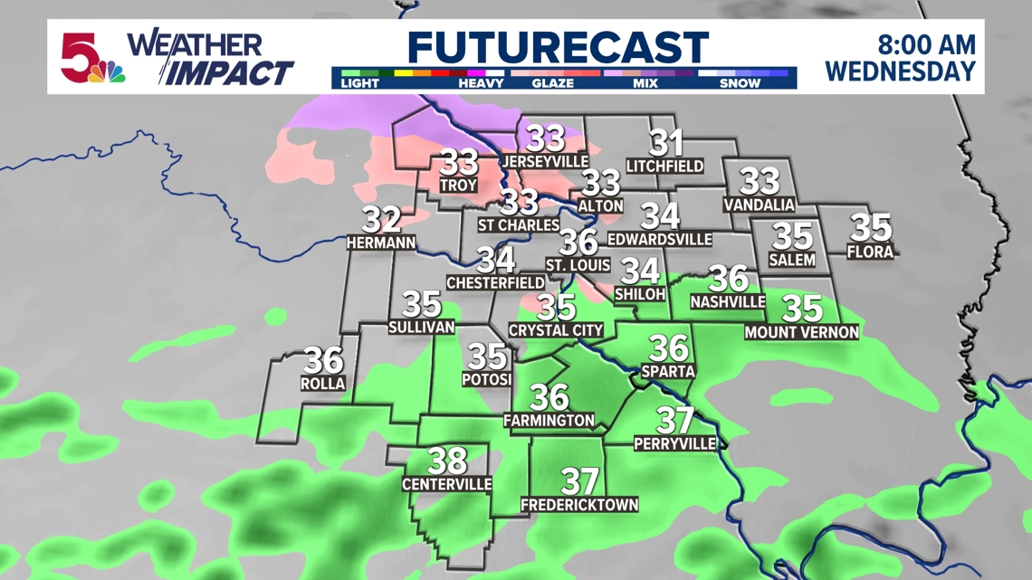
Below is the futurecast precipitation at 8 a.m. on Wednesday. Notice the temperatures are mainly above freezing, so where you see the pink color that’s where you could have freezing drizzle/rain for a few hours before it changes to all rain.
The chances of a snow day for students are low, even if freezing rain does fall. Meteorologist Jim Castillo said roads shouldn’t be affected by freezing rain, due to relatively warm ground temperatures. The most likely impact freezing rain this go around, would be on elevated surfaces, like trees, patios, power lines, overpasses and bridges, but this would be for only a few hours in in the morning, north. Less than .10″ of ice is possible far north into Pike Co. Missouri. The Weather Impact forecast team is expecting low impacts from the freezing drizzle and rain.
Regardless of the type of precipitation, meteorologists forecast around a quarter of an inch of rain to fall throughout the region from Wednesday morning into Wednesday night. Any possible downpours will depend on if we have some thundershowers around Wednesday evening. Wet or damp roads are likely the biggest impacts with this system.
This is a developing system. This article will be updated as new forecast information is released.